HATALMAS VÁLASZTÉK
Több mint 4 millió angol nyelvű könyv kitűnő áron.

| ISBN | 9780008652890 |
|---|---|
| Szerző | Collins |
| Kiadó | Collins |
| Nyelv | english |
| Kötés | Spiral |
| A kiadás éve | 2024 |
| Oldalak száma | 80 |
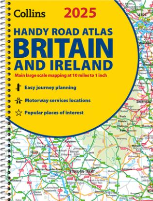
This easy-to-use, handy A5 road atlas with spiral binding features extremely clear route planning maps of Britain and Ireland, and fits neatly into your glove box or bag.
The maps of Britain are at 10 miles to 1 inch (1:625,000) and the whole of Ireland is covered at 15.8 miles to 1 inch (1:1,000,000). There are also a selection of more detailed urban area maps at 4.5 miles to 1 inch (1:285,000) to aid route planning in these busy areas.
Main features:

Több mint 4 millió angol nyelvű könyv kitűnő áron.

25 500 Ft vagy nagyobb rendelés esetén a szállítás ingyenes

A könyvek árait igyekszünk a földhöz közel tartani és mindig a kiadó által ajánlott ár alatt.

Számunkra a legfontosabb az Ön elégedettsége. Könyveket árulunk, mert szeretjük őket. Nem transznacionális óriások vagyunk, hanem becsületes cseh cég. Ezenfelül a kitűnő könyveket saját blogunkban véleményezzük.

Megkaptuk a "Megbízható Bolt" címet az arukereso.hu portálon. Az értékeléseket megtekintheti itt